Object and Shape Detection

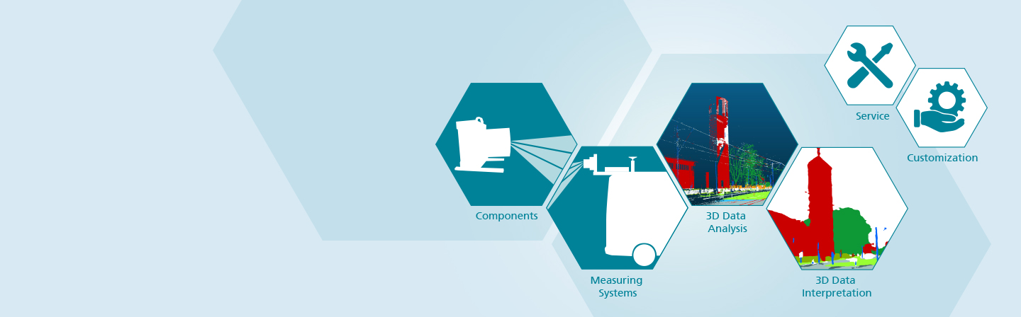
3D data acquisition and automated data analysis

In the »Object and Shape Detection« business unit, systems are developed for 3D detection of the geometry and location of objects. As a rule, the detection takes place from moving platforms and extends over a wide distance range – from tenths of a millimeter to the 100-meter range. The focus is on the research and development of very fast and robust measuring systems based on time-of-flight measurement technology or camera systems.

The spectrum of our customized measuring systems ranges from highly complex multispectral laser scanners to smartphones as measuring devices, which we equip with specially developed software for this purpose.

When evaluating data, we take advantage of the opportunities offered by current groundbreaking developments in machine learning. With the help of specifically trained artificial neural networks, we are able to automatically identify a large number of object classes and object surfaces in measurement data. This enables us to extract maximum information from measurement data and to gain new information from existing measurement results. Our turnkey systems consist of high-precision measuring devices with downstream automated data analysis.

Digitalized planning and maintenance of infrastructure

Our measurement systems contribute to efficient infrastructure planning and maintenance, e.g. in the rail and road network, when inspecting tunnels, bridges or buildings. They provide high-precision digital measurement data as the basis for digital planning processes, for example in the context of smart cities. In addition to geometric measurements, our systems are able to detect moisture from a distance and also inspect objects under water. This makes it possible, for example, to assess the condition of vegetation quickly and over large areas.

Our offer in the imaging object and shape detection
 

  • Development of tailor-made measuring systems
  • Software development along the entire 3D data process chain
  • Development of artifical neural networks (ANN) for automated data analysis
  • Technology consulting and evaluation
  • Feasibility studies and aptitude tests

Systems in operation

Our mobile laser scanner systems are used for condition monitoring by leading 3D measurement technology providers, by Deutsche Bahn (DB), Österreichische Bundesbahnen (ÖBB) and numerous other railway operators worldwide. Service companies and network operators such as Deutsche Telekom rely on measurement vehicles equipped with our multi-sensor systems to record the condition of roads and to digitize planning process for expansion of the fibre optic network . The German Federal Highway Research Institute (BASt) uses our measuring systems as reference devices. Mobile laser scanner systems by Fraunhofer IPM are world leaders in terms of measurement speed and accuracy and are continuously being further developed using highly integrated and low-cost components from communication electronics.

News & Information


November 27–28, 2024

Mobile Laser Scanning Technology Workshop

We have put together an attractive program. Registration will be open soon.

We will be happy to welcome you at the Workshop in 2024!


Press release / 5.2.2024

Geomapping
maritime surfaces

The renowned Finnish Geospatial Research Institute (FGI) will use LiDAR systems developed by Fraunhofer IPM to survey maritime surfaces in the future. We will present the Airborne Bathymetric Laser Scanner ABS and the Underwater LiDAR ULi systems at Oceanology International 2024 from March 12 to 14 in London.


Press release / 23.11.2022

Compact system for topographical measurement of shallow bodies of water

As part of the ACQUA-3D research project, a team at Fraunhofer IPM is cooperating with partners from research and industry to develop a particularly small and lightweight bathymetric measurement system for use on UAVs, for the particular application of measuring shallow bodies of water.


Press release / 22.11.2022

The city as a digital twin

As part of the MuSiS project, Fraunhofer IPM and incontext.technology GmbH have joined forces to develop a process for creating a digital twin of urban environments. The process is intended to provide a solid data basis for construction or maintenance of urban infrastructure quickly and with deep granularity. The idea behind the MuSiS research project is that measurement systems installed on taxis, busses and streetcars record their environment while the vehicles drive along their usual route, constantly collecting up-to-date data.

Awards

Ken Brodlie Prize


Best paper award granted by Journal »Computer Graphics & Visual Computing«

A team of authors led by our colleague Bastian Stahl receives the Ken Brodlie Prize for their “Paper Real-time Indexing of Point Cloud Data During LiDAR Capture“ , in which the authors demonstrate strategies for real-time indexing of LiDAR data. 


Project MuSe-3D

Multispectral camera system surveys moorlands from the air

What is the state of marshlands in the face of climate change? To investigate this question, we supported RSS GmbH with technology and know-how for 3D data acquisition. Mounted on a drone, our multispectral camera system recorded data on the condition of the moorlands around the Bavarian town of Benediktbeuern. The results can be viewed in an interactive 3D map.


Press release / 1.2.2022

High-precision 3D surveying of the Liebensteinspeicher reservoir

On behalf of the Weiden Water Management Authority, GeoGroup GmbH and Fraunhofer IPM have now conducted a survey of 100 percent of the Liebensteinspeicher reservoir in Germany’s Upper Palatinate region.

Our Trade Fairs and Conferences 2024


Partners and Networks

  • CNA Center for Transportation & Logistics Neuer Adler e.V. Cluster Bahntechnik Bayern
  • Deutsche Gesellschaft für Photogrammetrie, Fernerkundung und Geoinformation e.V. (DGPF)
  • Deutsche Hydrographische Gesellschaft  e.V. (DHyG)